


The H.R. Frink Conservation Area at 381 and 384 Thrasher Road, Plainfield ON has hiking trails on the north side and south side of Thrasher Road for a total of 10 km of trails.
Explore H.R. Frink
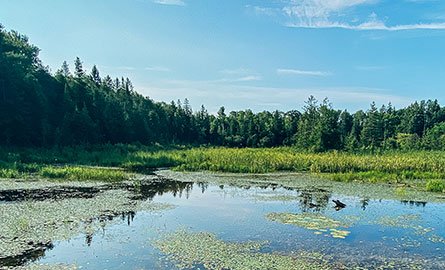
The north side features a network of forested trails leading visitors along the Moira River, around a silver maple swamp, through a mature hardwood forest, and to Parks Creek. The south side of the area contains several more kilometers of trails, including the popular Wetland Ecology Boardwalk. A graveled trail can be found leading from the parking lot to the wetland boardwalk for ease of access throughout the year.
Public parking for this area is located on the south side of Thrasher Road.
Things to look for:
- The Wetland Ecology Boardwalk and a variety of wetland fauna and flora
- Spring wildflowers
- The Moira River
- Cedar Creek lookout on Parks Creek
Trail Guide
Beginner Trails - 800 m
- Relatively even terrain
- Wide trail
Intermediate Trails - 5 km
- Some elevation gain
- Some steep sections
- Uneven terrain
Advanced Trails - 2.9 km
- Elevation gain
- Several long, steep sections
- Rough terrain with muddy sections
- Seasonal wet/water crossings
- Narrow trail
| Activities |
|
| Amenities |
|
|
Things to keep in mind during your visit |
|
When visiting Quinte Conservation's areas, please make sure to:
Please note:
|
|
Cross-country trails and motorized vehicles |
|
The cross-country skiing trails are not groomed and motorized vehicles are not permitted outside of designated parking areas. This includes, but is not limited to:
|

Trail map
View the trail map for the H.R. Frink Conservation Area.
Use this native tree guide to compliment your walk along the H.R. Frink Woodland Trail highlighting over 25 tree species.
A smartphone enabled trail map is also available via the free app Avenza Maps.
| How to use Avenza Maps |
|
Once the map is downloaded, you can track your location on the trails without the use of mobile data. Instructions for use are as follows:
Download Avenza MapsMap QR Code |

Parking
You must pay to park at this conservation area. There is a daily parking pass that you can use between areas. A daily pass is valid on the day of purchase between 6 am to 8 pm. Yearly parking passes are also available. Visit our parking page to learn more.
See an issue?
Help us keep our outdoor spaces clean and our wildlife safe! Please report a non-emergency issue or a concern.